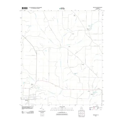
2011 Map of Shellman
USGS Topo · Published 2011About this map
The agrarian landscape of Randolph County unfolds around the central hubs of Shellman and Graves in this early 21st-century study. The terrain is defined by the winding paths of Ichawaynochaway Creek and its tributary, Little Ichawaynochaway Creek, which drain a region deeply rooted in local genealogy. Longstanding community focal points are documented through numerous burial grounds and places of worship, including Pierces Chapel Cemetery, Shiloh Cemetery, and New Bethel Cemetery.
Find a feature on this map
49 named features on this map. Tap any name to fly to it.
Don’t see what you’re looking for? This feature index may not catch every label — zoom into the map to look around manually.
Map Details
Editions of this 2011 Shellman Map
This is the sole edition of this map. No revisions or reprints were ever made.
Other maps of this area

1953 · Dothan
USGS Topo · 1:250,000

1954 · Dothan
USGS Topo · 1:250,000

1955 · Dothan
USGS Topo · 1:250,000

1956 · Sasser
USGS Topo · 1:62,500

1972 · Parrott
USGS Topo · 1:24,000
1972 · Benevolence
USGS Topo · 1:24,000

1972 · Shellman
USGS Topo · 1:24,000
1972 · Brooksville
USGS Topo · 1:24,000

1973 · Chickasawhatchee
USGS Topo · 1:24,000

1973 · Martins Crossroads
USGS Topo · 1:24,000