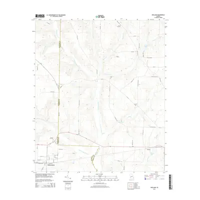
2014 Map of Shellman
USGS Topo · Published 2014About this map
The town of Shellman serves as the primary hub in this southwest Georgia landscape, situated along the Us-82 corridor. The geography is defined by a dense network of watercourses, most notably Ichawaynochaway Cr and its tributary Little Ichawaynochaway Cr, which carve through the terrain alongside Turkey Cr and Wolf Cr. For genealogists, the map is particularly detailed regarding local landmarks and burial sites, including the Rehoboth Church Cem west of town and the remote Pierces Chapel Cem in the north. The small settlement of Graves sits on the eastern edge of the survey, connected by a lattice of named rural routes like Jones Mill Rd and Melton Mill Rd. These roads and several named impoundments, such as McGills Pond and Stephens Pond, illustrate a long-standing agricultural and water-dependent economy that persists into the early 21st century.
Find a feature on this map
59 named features on this map. Tap any name to fly to it.
Don’t see what you’re looking for? This feature index may not catch every label — zoom into the map to look around manually.
Map Details
Editions of this 2014 Shellman Map
This is the sole edition of this map. No revisions or reprints were ever made.
Other maps of this area

1953 · Dothan
USGS Topo · 1:250,000

1954 · Dothan
USGS Topo · 1:250,000

1955 · Dothan
USGS Topo · 1:250,000

1956 · Sasser
USGS Topo · 1:62,500

1972 · Parrott
USGS Topo · 1:24,000
1972 · Benevolence
USGS Topo · 1:24,000

1972 · Shellman
USGS Topo · 1:24,000
1972 · Brooksville
USGS Topo · 1:24,000

1973 · Chickasawhatchee
USGS Topo · 1:24,000

1973 · Martins Crossroads
USGS Topo · 1:24,000