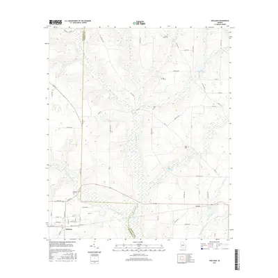
2017 Map of Shellman
USGS Topo · Published 2017About this map
The Shellman community and the smaller settlement of Graves anchor this southwest Georgia landscape, situated along the border of Randolph Co and Terrell Co. The geography is defined by a dense network of watercourses, most notably the meandering Ichawaynochaway Cr and its tributary, Little Ichawaynochaway Cr, which create a complex drainage pattern across the agricultural terrain.
Find a feature on this map
64 named features on this map. Tap any name to fly to it.
Don’t see what you’re looking for? This feature index may not catch every label — zoom into the map to look around manually.
Map Details
Editions of this 2017 Shellman Map
This is the sole edition of this map. No revisions or reprints were ever made.
Other maps of this area

1953 · Dothan
USGS Topo · 1:250,000

1954 · Dothan
USGS Topo · 1:250,000

1955 · Dothan
USGS Topo · 1:250,000

1956 · Sasser
USGS Topo · 1:62,500

1972 · Parrott
USGS Topo · 1:24,000
1972 · Benevolence
USGS Topo · 1:24,000

1972 · Shellman
USGS Topo · 1:24,000
1972 · Brooksville
USGS Topo · 1:24,000

1973 · Chickasawhatchee
USGS Topo · 1:24,000

1973 · Martins Crossroads
USGS Topo · 1:24,000