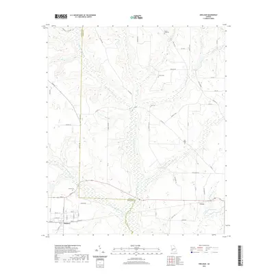
2020 Map of Shellman
USGS Topo · Published 2020About this map
Shellman anchors the southwestern corner of this West Georgia landscape, situated where the boundary between Randolph and Terrell Counties shapes the local geography. The area is defined by an intricate network of waterways, most notably the winding courses of Ichawaynochaway Creek and its tributary, Little Ichawaynochaway Creek. These streams cut through a terrain marked by numerous small ridges and valleys, creating a drainage system that includes Turkey Creek, Wolf Creek, and Chenube Creek.
Find a feature on this map
61 named features on this map. Tap any name to fly to it.
Don’t see what you’re looking for? This feature index may not catch every label — zoom into the map to look around manually.
Map Details
Editions of this 2020 Shellman Map
This is the sole edition of this map. No revisions or reprints were ever made.
Other maps of this area

1953 · Dothan
USGS Topo · 1:250,000

1954 · Dothan
USGS Topo · 1:250,000

1955 · Dothan
USGS Topo · 1:250,000

1956 · Sasser
USGS Topo · 1:62,500

1972 · Parrott
USGS Topo · 1:24,000
1972 · Benevolence
USGS Topo · 1:24,000

1972 · Shellman
USGS Topo · 1:24,000
1972 · Brooksville
USGS Topo · 1:24,000

1973 · Chickasawhatchee
USGS Topo · 1:24,000

1973 · Martins Crossroads
USGS Topo · 1:24,000