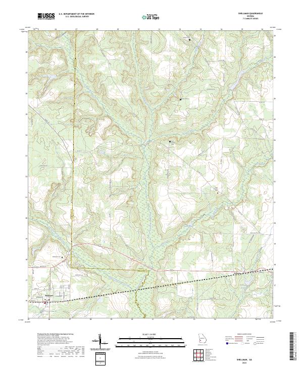
2024 Map of Shellman
USGS Topo · Published 2024About this map
Shellman sits at the western edge of this agricultural landscape in Randolph and Terrell Counties, where the terrain is deeply etched by a network of south-flowing waterways. The prominent Ichawaynochaway Creek and its many tributaries, including Wolf Creek and Turkey Creek, define the drainage patterns of this Southwest Georgia region. The map reveals a rural social geography centered on several burial sites, such as Sand Hill Cem and First Shiloh Cem, which often serve as the remaining markers of early community hubs. To the east, the settlement of Graves is situated near Stephans Pond, illustrating the typical placement of small towns along transit corridors and water sources. A dense grid of local roads, from Melton Mill Rd to School House Rd, suggests a legacy of land division and local industry tied to the surrounding creeks.
Find a feature on this map
62 named features on this map. Tap any name to fly to it.
Don’t see what you’re looking for? This feature index may not catch every label — zoom into the map to look around manually.
Map Details
Editions of this 2024 Shellman Map
This is the sole edition of this map. No revisions or reprints were ever made.
Other maps of this area

1953 · Dothan
USGS Topo · 1:250,000

1954 · Dothan
USGS Topo · 1:250,000

1955 · Dothan
USGS Topo · 1:250,000

1956 · Sasser
USGS Topo · 1:62,500

1972 · Parrott
USGS Topo · 1:24,000
1972 · Benevolence
USGS Topo · 1:24,000

1972 · Shellman
USGS Topo · 1:24,000
1972 · Brooksville
USGS Topo · 1:24,000

1973 · Chickasawhatchee
USGS Topo · 1:24,000

1973 · Martins Crossroads
USGS Topo · 1:24,000