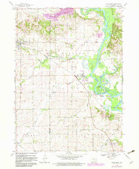
1968 Map of Shellsburg
USGS Topo · Published 1983About this map
The Cedar River creates a wide, branching riparian corridor through this Benton and Linn County landscape, defining the character of the riverbottom lands and adjacent bluffs. Local transportation and industry at the time of this 1968 survey were anchored by the Iowa Northern and Illinois Central Gulf railroads, which facilitated movement between the settlements of Shellsburg, Palo, and Covington.
Find a feature on this map
39 named features on this map. Tap any name to fly to it.
Don’t see what you’re looking for? This feature index may not catch every label — zoom into the map to look around manually.
Map Details
Editions of this 1968 Shellsburg Map
3 editions found
Other maps of this area

1887 · Cedar Rapids
USGS Topo · 1:62,500

1888 · Shellsburg
USGS Topo · 1:62,500

1888 · Marion
USGS Topo · 1:62,500

1888 · Amana
USGS Topo · 1:62,500

1889 · Marion
USGS Topo · 1:62,500

1889 · Amana
USGS Topo · 1:62,500

1889 · Shellsburg
USGS Topo · 1:62,500

1891 · Cedar Rapids
USGS Topo · 1:62,500

1899 · Amana
USGS Topo · 1:62,500

1899 · Shellsburg
USGS Topo · 1:62,500