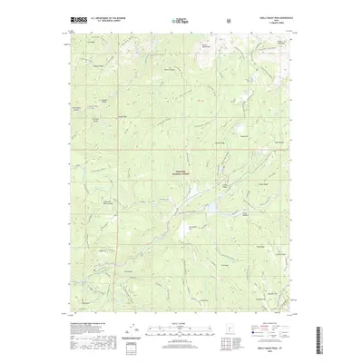
2020 Map of Shelly Baldy Peak
USGS Topo · Published 2020About this map
Shelly Baldy Peak dominates the northern skyline of this high-altitude landscape within the Fishlake National Forest. The map documents a complex network of ridgelines and watercourses, including the Tushar Mountains and Grizzly Ridges, which define the drainage basins for Sweetwater Creek and Sawmill Fork. The presence of Tungsten Hollow suggests the mineral interests that have historically characterized this part of Piute County, while the naming of Van Fleet Hollow and Britts Meadows preserves the identity of early local settlers and ranching families.
Find a feature on this map
88 named features on this map. Tap any name to fly to it.
Don’t see what you’re looking for? This feature index may not catch every label — zoom into the map to look around manually.
Map Details
Editions of this 2020 Shelly Baldy Peak Map
This is the sole edition of this map. No revisions or reprints were ever made.
Other maps of this area

1885 · Beaver
USGS Topo · 1:250,000

1937 · Delano Peak
USGS Topo · 1:48,000

1943 · Delano Peak
USGS Topo · 1:62,500

1953 · Richfield
USGS Topo · 1:250,000

1954 · Beaver SE
USGS Topo · 1:24,000

1954 · Beaver NE
USGS Topo · 1:24,000

1958 · Richfield
USGS Topo · 1:250,000

1958 · Beaver
USGS Topo · 1:62,500

1966 · Circleville
USGS Topo · 1:24,000
1971 · Kane Canyon
USGS Topo · 1:24,000