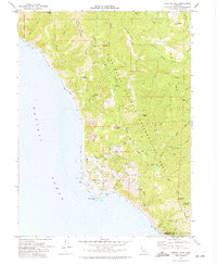
1969 Map of Shelter Cove
USGS Topo · Published 1974About this map
Shelter Cove sits at the edge of the Pacific Ocean near Point Delgada, serving as a coastal outpost where the steep terrain of the King Range National Conservation Area meets the sea. This 1969 survey captures the area’s rugged character, defined by high ridges like Paradise Ridge and the Mattole River winding through the eastern hills. The infrastructure of the late 1960s is evident in the development of Redwood Road and the Filtration Plant, alongside a series of recreation sites including Horse Mtn Campground and Tolkan Campground. The map reveals a landscape managed for both conservation and utility, featuring numerous water tanks, a Sewage Disposal site, and old Mines situated beneath Queen Peak, documenting the transition of this isolated coastline into a structured recreational and residential landscape.
Find a feature on this map
46 named features on this map. Tap any name to fly to it.
Don’t see what you’re looking for? This feature index may not catch every label — zoom into the map to look around manually.
Map Details
Editions of this 1969 Shelter Cove Map
3 editions found
Other maps of this area

1920 · Pt. Delagda
USGS Topo · 1:62,500

1921 · Briceland
USGS Topo · 1:62,500

1949 · Eureka
USGS Topo · 1:250,000

1949 · Point Delgada
USGS Topo · 1:62,500

1949 · Garberville
USGS Topo · 1:62,500

1950 · Piercy
USGS Topo · 1:62,500

1951 · Garberville
USGS Topo · 1:62,500

1951 · Point Delgada
USGS Topo · 1:62,500

1957 · Ukiah
USGS Topo · 1:250,000

1958 · Redding
USGS Topo · 1:250,000