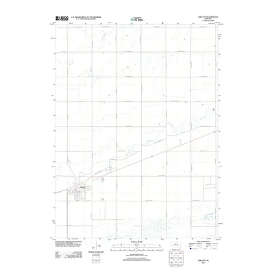
2011 Map of Shelton
USGS Topo · Published 2011About this map
The settlement of Shelton occupies the southwestern portion of this Platte Valley landscape, anchored by the Shelton Post Office and a grid of streets including E 2nd St and 9th St. The surrounding Buffalo County terrain is defined by the parallel courses of the Wood River and Prairie Creek, which trend northeast across a network of section-line roads. A significant historical corridor is preserved in the alignment of W Old Military Rd, which follows the northern bank of the river through the center of the sheet. The spatial organization of the area reflects its agricultural heritage, with long north-south routes like Wiseman Rd and S 190th Rd providing access to the fertile valley floor. Modern institutional presence is noted at Campus Dr, while residential and service roads like W Burmood Rd and W Holling Rd branch out from the town center.
Find a feature on this map
31 named features on this map. Tap any name to fly to it.
Don’t see what you’re looking for? This feature index may not catch every label — zoom into the map to look around manually.
Map Details
Editions of this 2011 Shelton Map
This is the sole edition of this map. No revisions or reprints were ever made.
Other maps of this area

1894 · Kenesaw
USGS Topo · 1:62,500

1894 · Minden
USGS Topo · 1:62,500

1895 · Wood River
USGS Topo · 1:62,500

1896 · Wood River
USGS Topo · 1:125,000

1955 · Grand Island
USGS Topo · 1:250,000

1957 · Grand Island
USGS Topo · 1:250,000

1958 · Grand Island
USGS Topo · 1:250,000

1962 · Denman
USGS Topo · 1:24,000

1962 · Prosser
USGS Topo · 1:24,000
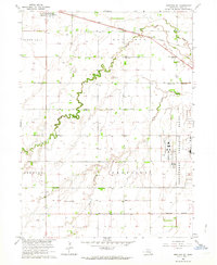
1962 · Shelton NE
USGS Topo · 1:24,000