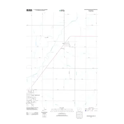
2013 Map of Shenandoah East
USGS Topo · Published 2013About this map
Essex and the northern edge of Shenandoah anchor this Page County landscape, where the meandering course of the E Nishnabotna River cuts a wide valley through the agricultural heartland of southwest Iowa. The map reveals a highly structured section-line road network, defining a geometry of farmsteads and rural properties that surround the town centers. At the center of the sheet, Essex is clearly defined by its street grid, including California Ave and N Ave, and serves as a local hub with the nearby Essex Golf and Recreation grounds. Further south, the outskirts of Shenandoah show a transition from suburban streets like E Pioneer Ave and Anna Crose Hwy into the open drainage basins of Rocky Br and Eightmile Br. The detailed mapping of small waterways such as Fourmile Cr provides a precise view of the local topography and drainage patterns essential to the region's farming heritage.
Find a feature on this map
59 named features on this map. Tap any name to fly to it.
Don’t see what you’re looking for? This feature index may not catch every label — zoom into the map to look around manually.
Map Details
Editions of this 2013 Shenandoah East Map
This is the sole edition of this map. No revisions or reprints were ever made.
Other maps of this area

1939 · Farragut
USGS Topo · 1:62,500

1940 · Farragut
USGS Topo · 1:62,500

1940 · Coin
USGS Topo · 1:62,500

1943 · Coin
USGS Topo · 1:62,500

1955 · Nebraska City
USGS Topo · 1:250,000

1957 · Nebraska City
USGS Topo · 1:250,000

1958 · Nebraska City
USGS Topo · 1:250,000

1978 · Shenandoah East
USGS Topo · 1:24,000

1978 · Stanton SW
USGS Topo · 1:24,000
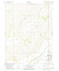
1978 · Shenandoah West
USGS Topo · 1:24,000