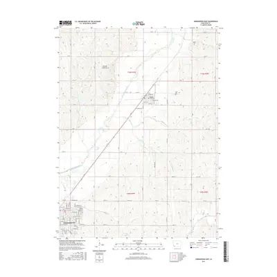
2015 Map of Shenandoah East
USGS Topo · Published 2015About this map
The town of Shenandoah anchor the southwestern corner of this survey, where a dense grid of streets including W Valley Ave and E Washington Ave meet the meandering East Nishnabotna River. Moving northeast, the landscape transitions into the agricultural heart of Page County, centering on the community of Essex. This area is defined by its deep-rooted rural history, evidenced by several well-maintained burial grounds such as the Saint John Evangelical Lutheran Cem and Hadden Cem. The drainage patterns of Rocky Br and Eightmile Br carve through the sections, illustrating the natural irrigation that has long supported the region's farming economy. The map provides a detailed view of the 2015 road network, tracing the transition from named town streets to the systematic gravel and paved level roads that connect isolated farmsteads and historic family tracts.
Find a feature on this map
56 named features on this map. Tap any name to fly to it.
Don’t see what you’re looking for? This feature index may not catch every label — zoom into the map to look around manually.
Map Details
Editions of this 2015 Shenandoah East Map
This is the sole edition of this map. No revisions or reprints were ever made.
Other maps of this area

1939 · Farragut
USGS Topo · 1:62,500

1940 · Farragut
USGS Topo · 1:62,500

1940 · Coin
USGS Topo · 1:62,500

1943 · Coin
USGS Topo · 1:62,500

1955 · Nebraska City
USGS Topo · 1:250,000

1957 · Nebraska City
USGS Topo · 1:250,000

1958 · Nebraska City
USGS Topo · 1:250,000

1978 · Shenandoah East
USGS Topo · 1:24,000

1978 · Stanton SW
USGS Topo · 1:24,000
1978 · Shenandoah West
USGS Topo · 1:24,000