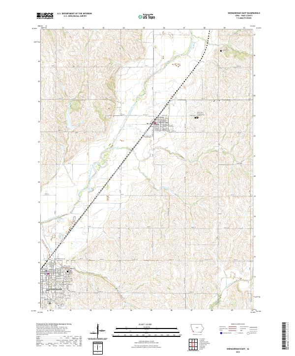
2022 Map of Shenandoah East
USGS Topo · Published 2022About this map
Shenandoah and Essex anchor this agricultural region of Page County, Iowa, where the landscape is defined by the winding course of the East Nishnabotna River. The modern layout of Shenandoah is visible in the southwest, featuring residential streets like W Lowell Ave and E Ferguson Ave near the sprawling Rose Hill Cem. Further north, the town of Essex is situated at a key rail-trail intersection, where the Wabash Trace Nature Trl cuts diagonally through the townships of t70n r39w and t69n r39w. This map captures a quintessential Midwestern pattern of section-line roads, such as 190th St and Level B Rd, punctuated by small rural burial grounds like Hadden Cem and the Saint John Evangelical Lutheran Cem. Significant drainage features including Rocky Br and Eightmile Br carve through the tilled fields that characterize this productive corner of the state.
Find a feature on this map
54 named features on this map. Tap any name to fly to it.
Don’t see what you’re looking for? This feature index may not catch every label — zoom into the map to look around manually.
Map Details
Editions of this 2022 Shenandoah East Map
This is the sole edition of this map. No revisions or reprints were ever made.
Other maps of this area

1939 · Farragut
USGS Topo · 1:62,500

1940 · Farragut
USGS Topo · 1:62,500

1940 · Coin
USGS Topo · 1:62,500

1943 · Coin
USGS Topo · 1:62,500

1955 · Nebraska City
USGS Topo · 1:250,000

1957 · Nebraska City
USGS Topo · 1:250,000

1958 · Nebraska City
USGS Topo · 1:250,000

1978 · Shenandoah East
USGS Topo · 1:24,000

1978 · Stanton SW
USGS Topo · 1:24,000
1978 · Shenandoah West
USGS Topo · 1:24,000