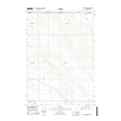
2015 Map of Shepard Reservoir
USGS Topo · Published 2015About this map
The Montana Wyoming border crosses this arid high-plains landscape, where the management of water defines the human footprint. A series of catchments and artificial pools, including Shepard Reservoir, Crow Creek Reservoir, and Strawberry Hill Reservoir, are strategically placed among the drainages of Crow Creek and Bull Creek. These water sources support the ranching and industrial activities of the region, which is marked by a network of specialized routes like Bentonite Haul Rd and Crow Creek Co Rd.
Find a feature on this map
34 named features on this map. Tap any name to fly to it.
Don’t see what you’re looking for? This feature index may not catch every label — zoom into the map to look around manually.
Map Details
Editions of this 2015 Shepard Reservoir Map
This is the sole edition of this map. No revisions or reprints were ever made.
Other maps of this area

1901 · Aladdin
USGS Topo · 1:125,000

1903 · Aladdin
USGS Topo · 1:125,000

1954 · Ekalaka
USGS Topo · 1:250,000

1954 · Gillette
USGS Topo · 1:250,000

1955 · Gillette
USGS Topo · 1:250,000

1956 · Ekalaka
USGS Topo · 1:250,000

1957 · Mona
USGS Topo · 1:62,500

1957 · Colony
USGS Topo · 1:62,500

1958 · Gillette
USGS Topo · 1:250,000

1958 · Ekalaka
USGS Topo · 1:250,000