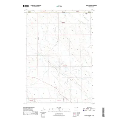
2017 Map of Shepard Reservoir
USGS Topo · Published 2017About this map
The Montana-Wyoming border cuts across this rangeland landscape, where the northern edge of Carter County meets Crook County. The terrain is defined by a dense network of intermittent drainages feeding the Belle Fourche River and its major tributaries, including Crow Creek and Humboldt Creek. This territory is characterized by its agricultural water management, with numerous small impoundments like Shepard Reservoir, Lone Tree Reservoir, and Bulb Creek Reservoir distributed across the prairie to support livestock in an arid environment. Transportation follows the contours of the land and old survey lines, notably via the Bentonite Road and Bentonite Haul Road, which point to the industrial heritage of the region. Natural landmarks such as Mud Butte and Antelope Hill provide the few significant elevation changes in this open expanse.
Find a feature on this map
33 named features on this map. Tap any name to fly to it.
Don’t see what you’re looking for? This feature index may not catch every label — zoom into the map to look around manually.
Map Details
Editions of this 2017 Shepard Reservoir Map
This is the sole edition of this map. No revisions or reprints were ever made.
Other maps of this area

1901 · Aladdin
USGS Topo · 1:125,000

1903 · Aladdin
USGS Topo · 1:125,000

1954 · Ekalaka
USGS Topo · 1:250,000

1954 · Gillette
USGS Topo · 1:250,000

1955 · Gillette
USGS Topo · 1:250,000

1956 · Ekalaka
USGS Topo · 1:250,000

1957 · Mona
USGS Topo · 1:62,500

1957 · Colony
USGS Topo · 1:62,500

1958 · Gillette
USGS Topo · 1:250,000

1958 · Ekalaka
USGS Topo · 1:250,000