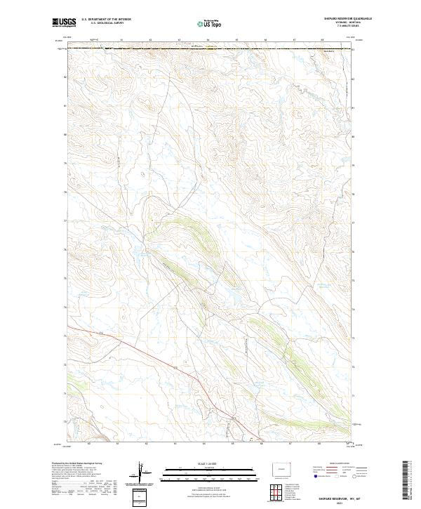
2021 Map of Shepard Reservoir
USGS Topo · Published 2021About this map
Bentonite Haul Rd and Bentonite Rd cut through the arid landscape of northern Crook County, where the region's ranching and industrial utility is defined by water management. Numerous basins such as Shepard Reservoir, Bull Cr Reservoir, and Antelope Hill Reservoir dot the terrain, capturing seasonal runoff from the network of drainages including Crow Cr and Humboldt Cr. The high point of Mud Butte stands out near the northern boundary line between Wyoming and Montana. In the southwestern corner, the Belle Fourche River meanders across the section line, marking a shift in the local topography. This 2021 study illustrates a modern working landscape where specialized access roads like Crow Creek Co Rd link remote water storage sites across the high plains.
Find a feature on this map
29 named features on this map. Tap any name to fly to it.
Don’t see what you’re looking for? This feature index may not catch every label — zoom into the map to look around manually.
Map Details
Editions of this 2021 Shepard Reservoir Map
This is the sole edition of this map. No revisions or reprints were ever made.
Other maps of this area

1901 · Aladdin
USGS Topo · 1:125,000

1903 · Aladdin
USGS Topo · 1:125,000

1954 · Ekalaka
USGS Topo · 1:250,000

1954 · Gillette
USGS Topo · 1:250,000

1955 · Gillette
USGS Topo · 1:250,000

1956 · Ekalaka
USGS Topo · 1:250,000

1957 · Mona
USGS Topo · 1:62,500

1957 · Colony
USGS Topo · 1:62,500

1958 · Gillette
USGS Topo · 1:250,000

1958 · Ekalaka
USGS Topo · 1:250,000