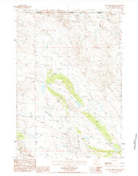
1984 Map of Shepard Reservoir
USGS Topo · Published 1984About this map
The high plains of the Montana Wyoming border region define this landscape, where the northern edge of Crook Co meets the southern boundary of Carter Co. The terrain is shaped by a network of seasonal watercourses including Bull Creek, Crow Creek, and Humboldt Creek, all feeding into the larger drainage basin. Human activity is marked by isolated homesteads such as Crogo Ranch, Newland Ranch, and Raber Ranch, which are situated among the coulees and draws of this ranching country.
Find a feature on this map
18 named features on this map. Tap any name to fly to it.
Don’t see what you’re looking for? This feature index may not catch every label — zoom into the map to look around manually.
Map Details
Editions of this 1984 Shepard Reservoir Map
This is the sole edition of this map. No revisions or reprints were ever made.
Other maps of this area

1901 · Aladdin
USGS Topo · 1:125,000

1903 · Aladdin
USGS Topo · 1:125,000

1954 · Ekalaka
USGS Topo · 1:250,000

1954 · Gillette
USGS Topo · 1:250,000

1955 · Gillette
USGS Topo · 1:250,000

1956 · Ekalaka
USGS Topo · 1:250,000

1957 · Mona
USGS Topo · 1:62,500

1957 · Colony
USGS Topo · 1:62,500

1958 · Gillette
USGS Topo · 1:250,000

1958 · Ekalaka
USGS Topo · 1:250,000