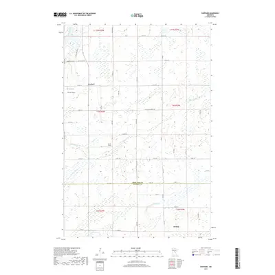
2019 Map of Shephard
USGS Topo · Published 2019About this map
The boundary between Crow Wing and Morrison counties anchors this rural landscape, which is defined by a dense network of marshes and watercourses. Small settlements like Shephard and Harding serve as quiet hubs for the surrounding agricultural and wetland terrain. The area's topography is notably marked by Vinegar Lake in the south and the winding paths of the Platte River and Nokasippi River. Local history and utility are found in landmarks such as the Pine Tree Cem and Barrett Airport, while the landscape is stitched together by a grid of county roads including Co Rd 23 SE and Co Rd 139. This map captures a quintessential Central Minnesota environment where drainage and surface water have dictated the patterns of local infrastructure and settlement.
Find a feature on this map
36 named features on this map. Tap any name to fly to it.
Don’t see what you’re looking for? This feature index may not catch every label — zoom into the map to look around manually.
Map Details
Editions of this 2019 Shephard Map
This is the sole edition of this map. No revisions or reprints were ever made.
Other maps of this area

1912 · Deerwood
USGS Topo · 1:62,500

1914 · Deerwood
USGS Topo · 1:62,500

1915 · Brainerd
USGS Topo · 1:62,500

1918 · Brainerd
USGS Topo · 1:62,500

1948 · Lastrup
USGS Topo · 1:62,500

1950 · Lastrup
USGS Topo · 1:62,500

1953 · Duluth
USGS Topo · 1:250,000

1953 · Brainerd
USGS Topo · 1:250,000

1957 · Brainerd
USGS Topo · 1:250,000

1958 · Brainerd
USGS Topo · 1:250,000