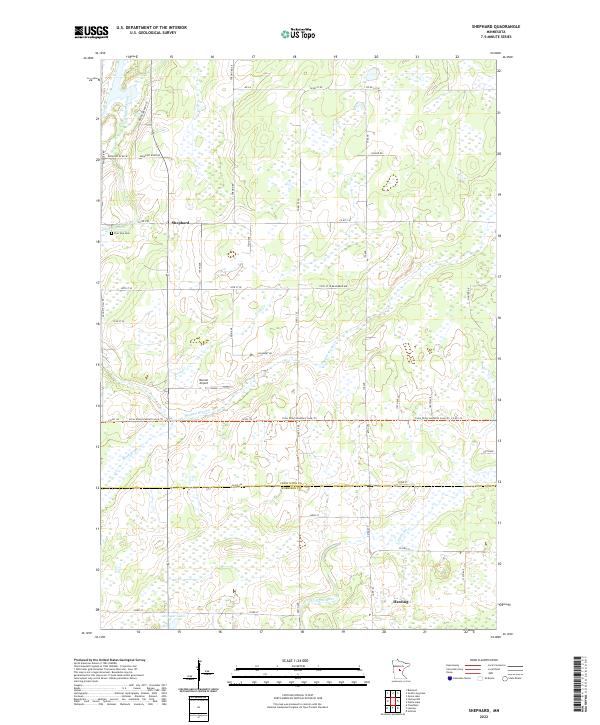
2022 Map of Shephard
USGS Topo · Published 2022About this map
The Platte River meanders through the southern portion of this landscape, marking a clear drainage pattern for the surrounding wetlands and fields at the Crow Wing Co Morrison Co boundary. In the north, the small settlement of Shephard sits near Daggett Brook, where local landmarks like the Pine Tree Cem provide specific points of interest for genealogical research. The terrain is characterized by numerous small water bodies and seasonal streams, including Coon Cr and Black Brook, which feed into the larger river systems. In the central area, the Barrett Airport and the Crow Wing Southern Loop Trl indicate a mix of small-scale aviation and recreational transit. The road network, including Co HWY 51 and various township routes like Nokasippi River RD, connects these rural outposts and family homesteads across the townships.
Find a feature on this map
36 named features on this map. Tap any name to fly to it.
Don’t see what you’re looking for? This feature index may not catch every label — zoom into the map to look around manually.
Map Details
Editions of this 2022 Shephard Map
This is the sole edition of this map. No revisions or reprints were ever made.
Other maps of this area

1912 · Deerwood
USGS Topo · 1:62,500

1914 · Deerwood
USGS Topo · 1:62,500

1915 · Brainerd
USGS Topo · 1:62,500

1918 · Brainerd
USGS Topo · 1:62,500

1948 · Lastrup
USGS Topo · 1:62,500

1950 · Lastrup
USGS Topo · 1:62,500

1953 · Duluth
USGS Topo · 1:250,000

1953 · Brainerd
USGS Topo · 1:250,000

1957 · Brainerd
USGS Topo · 1:250,000

1958 · Brainerd
USGS Topo · 1:250,000