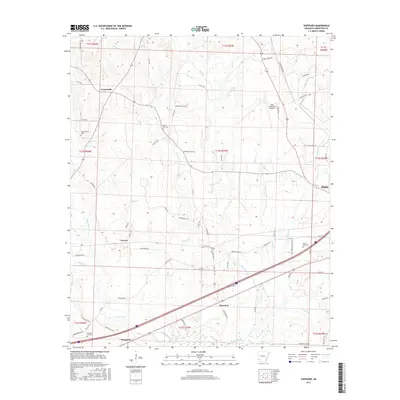
2017 Map of Sheppard
USGS Topo · Published 2017About this map
Bois D'Arc Cr and its numerous tributaries, including Sandy Bois d'Arc Cr and Mud Cr, define the drainage patterns across this Hempstead County landscape. The area is characterized by a network of rural settlements such as Guernsey, Sheppard, and Powers, connected by a web of local roads like Old Hwy 67 and Old Liberty Rd. The presence of several family and community burial sites, including Westmoreland Cem, Bright Star Cem, and Flowers Hill Cem, provides significant points of interest for genealogical research. The northeastern corner of the map features the Hope Municipal Airport, while the southern reaches are marked by the winding path of Black Br. This survey shows the transition from the more developed outskirts of Hope to the wooded bottoms and agricultural lands of the surrounding countryside.
Find a feature on this map
77 named features on this map. Tap any name to fly to it.
Don’t see what you’re looking for? This feature index may not catch every label — zoom into the map to look around manually.
Map Details
Editions of this 2017 Sheppard Map
This is the sole edition of this map. No revisions or reprints were ever made.
Other maps of this area

1951 · Blevins
USGS Topo · 1:24,000

1951 · Patmos
USGS Topo · 1:24,000

1951 · Fulton
USGS Topo · 1:24,000

1951 · Columbus
USGS Topo · 1:24,000

1951 · Sheppard
USGS Topo · 1:24,000

1951 · Spring Hill
USGS Topo · 1:24,000

1951 · Washington
USGS Topo · 1:24,000

1951 · Hope
USGS Topo · 1:24,000

1951 · Mc Nab
USGS Topo · 1:24,000

1953 · El Dorado
USGS Topo · 1:250,000