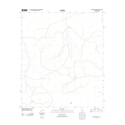
2012 Map of Sherbino Mesa
USGS Topo · Published 2012About this map
Sherbino Mesa anchors this landscape in Pecos County, where the topography is defined by high tablelands and the drainage patterns of the surrounding West Texas terrain. The map documents the persistent ranching legacy of the region, specifically identifying three primary landholdings that serve as the focal points for human activity in this arid environment. These include Hillin Ranch in the north, Harrelson Ranch near the center, and Ligon Ranch in the south. The sparse network of roads and trails illustrates the vast distances between these isolated ranching centers, reflecting the enduring rural character of the Trans-Pecos frontier into the early twenty-first century.
Find a feature on this map
4 named features on this map. Tap any name to fly to it.
Don’t see what you’re looking for? This feature index may not catch every label — zoom into the map to look around manually.
Map Details
Editions of this 2012 Sherbino Mesa Map
This is the sole edition of this map. No revisions or reprints were ever made.
Other maps of this area

1929 · Independence Draw Quadrangle
USGS Topo · 1:125,000

1954 · Fort Stockton
USGS Topo · 1:250,000

1958 · Fort Stockton
USGS Topo · 1:250,000

1969 · Bootleg Canyon
USGS Topo · 1:24,000

1969 · Skyscraper Peak
USGS Topo · 1:24,000

1969 · Hackberry Draw NW
USGS Topo · 1:24,000

1969 · Hackberry Draw NE
USGS Topo · 1:24,000
1969 · Hat-A Ranch
USGS Topo · 1:24,000

1969 · Indian Mesa
USGS Topo · 1:24,000

1969 · Bakersfield
USGS Topo · 1:24,000