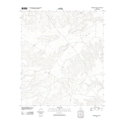
2010 Map of Sherbino Ranch
USGS Topo · Published 2010About this map
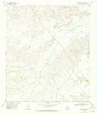
Sherbino Ranch and the surrounding rangeland of Pecos County are defined by a high-desert landscape of mesas and drainage basins as they appeared in 2010. The map centers on the namesake Sherbino Ranch, with neighboring livestock operations including Owens Ranch and Conn Ranch dispersed across the territory. This area shows the intersection of traditional West Texas ranching with modern industrial footprints, specifically the White Baker Oil Field located in the northern reaches. Much of the local geography is dictated by the winding path of Fourmile Draw, a seasonal watercourse that cuts through the prominent ridge lines. Infrastructure is sparse, primarily consisting of the winding corridor of Ranch Rd 2886, which serves as the primary artery connecting these isolated ranching headquarters.
Find a feature on this map
6 named features on this map. Tap any name to fly to it.
Don’t see what you’re looking for? This feature index may not catch every label — zoom into the map to look around manually.
Map Details
Editions of this 2010 Sherbino Ranch Map
This is the sole edition of this map. No revisions or reprints were ever made.
Other maps of this area

1929 · Independence Draw Quadrangle
USGS Topo · 1:125,000

1954 · Fort Stockton
USGS Topo · 1:250,000

1958 · Fort Stockton
USGS Topo · 1:250,000
1969 · Smoky Mountain Ranch
USGS Topo · 1:24,000

1969 · Hackberry Draw NE
USGS Topo · 1:24,000
1969 · Hat-A Ranch
USGS Topo · 1:24,000

1969 · Indian Mesa
USGS Topo · 1:24,000
1969 · Indian Mesa SE
USGS Topo · 1:24,000

1969 · Bakersfield
USGS Topo · 1:24,000
1969 · Sherbino Ranch
USGS Topo · 1:24,000