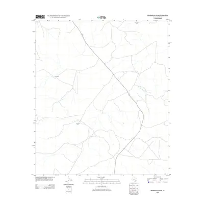
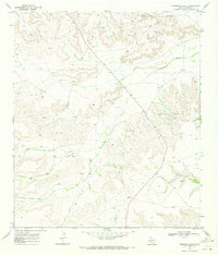
2012 Map of Sherbino Ranch
USGS Topo · Published 2012About this map
Sherbino Ranch and other family-held homesteads anchor this West Texas landscape in Pecos County. The terrain is defined by a network of drainage draws and intermittent streams that traverse the ranching country, reflecting the necessity of water management in this arid region. The presence of the White Baker Oil Field in the northern reaches of the quadrangle illustrates the overlap of traditional cattle ranching with the energy industry. Small hubs of activity like Conn Ranch and Owens Ranch are connected by local roads that follow the natural contours of the land, providing a record of rural land use and the persistence of naming traditions associated with specific family holdings.
Find a feature on this map
4 named features on this map. Tap any name to fly to it.
Don’t see what you’re looking for? This feature index may not catch every label — zoom into the map to look around manually.
Map Details
Editions of this 2012 Sherbino Ranch Map
This is the sole edition of this map. No revisions or reprints were ever made.
Other maps of this area

1929 · Independence Draw Quadrangle
USGS Topo · 1:125,000

1954 · Fort Stockton
USGS Topo · 1:250,000

1958 · Fort Stockton
USGS Topo · 1:250,000
1969 · Smoky Mountain Ranch
USGS Topo · 1:24,000

1969 · Hackberry Draw NE
USGS Topo · 1:24,000
1969 · Hat-A Ranch
USGS Topo · 1:24,000

1969 · Indian Mesa
USGS Topo · 1:24,000
1969 · Indian Mesa SE
USGS Topo · 1:24,000

1969 · Bakersfield
USGS Topo · 1:24,000
1969 · Sherbino Ranch
USGS Topo · 1:24,000