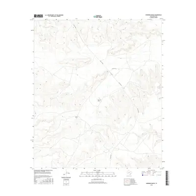
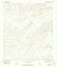
2016 Map of Sherbino Ranch
USGS Topo · Published 2016About this map
Sherbino Ranch and the nearby Hoopman Ranch anchor this West Texas landscape in Pecos County, illustrating the isolated ranching operations characteristic of the region. The map tracks the winding course of Fourmile Draw as it cuts through the terrain, providing a natural drainage feature in an otherwise arid environment. Transportation through this part of the county is defined by Ranch Rd 2886 and Co Rd 2886, which serve as the primary conduits between these remote holdings. This 2016 survey documents the modern layout of these historic land tracts, reflecting a traditional ranching economy that persists into the 21st century.
Find a feature on this map
5 named features on this map. Tap any name to fly to it.
Don’t see what you’re looking for? This feature index may not catch every label — zoom into the map to look around manually.
Map Details
Editions of this 2016 Sherbino Ranch Map
This is the sole edition of this map. No revisions or reprints were ever made.
Other maps of this area

1929 · Independence Draw Quadrangle
USGS Topo · 1:125,000

1954 · Fort Stockton
USGS Topo · 1:250,000

1958 · Fort Stockton
USGS Topo · 1:250,000
1969 · Smoky Mountain Ranch
USGS Topo · 1:24,000

1969 · Hackberry Draw NE
USGS Topo · 1:24,000
1969 · Hat-A Ranch
USGS Topo · 1:24,000

1969 · Indian Mesa
USGS Topo · 1:24,000
1969 · Indian Mesa SE
USGS Topo · 1:24,000

1969 · Bakersfield
USGS Topo · 1:24,000
1969 · Sherbino Ranch
USGS Topo · 1:24,000