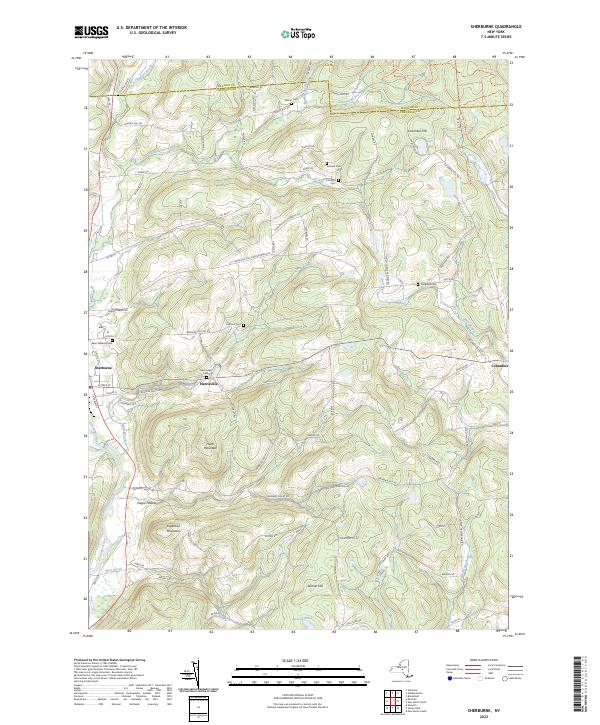
2023 Map of Sherburne
USGS Topo · Published 2023About this map
The Chenango River valley defines the western edge of this landscape, where the settlement of Sherburne sits along the riverbanks near the confluence of Mad Brook. Moving east into the upland terrain of Chenango County, the map reveals a high concentration of ancestral sites, including the Saint Malachy Cem, East Hill Cem, and Harrisville Cem. The geography is characterized by distinct peaks like Hunts Mountain and Sugarloaf Mountain, separated by drainages such as Negro Hollow. This area shows the enduring footprints of small communities like Harrisville and Columbus, connected by a network of rural routes including Turnpike Rd and Hardscrabble Rd. Natural landmarks like the Rexford Falls and Sears Pond punctuate the ridges, providing a detailed look at the water-carved topography of the Southern Tier's northern reaches.
Find a feature on this map
94 named features on this map. Tap any name to fly to it.
Don’t see what you’re looking for? This feature index may not catch every label — zoom into the map to look around manually.
Map Details
Editions of this 2023 Sherburne Map
This is the sole edition of this map. No revisions or reprints were ever made.
Other maps of this area

1902 · Morrisville
USGS Topo · 1:62,500

1903 · Norwich
USGS Topo · 1:62,500

1907 · Sangerfield
USGS Topo · 1:62,500

1910 · New Berlin
USGS Topo · 1:62,500

1912 · New Berlin
USGS Topo · 1:62,500

1943 · New Berlin North
USGS Topo · 1:24,000

1943 · New Berlin South
USGS Topo · 1:24,000

1943 · Hubbardsville
USGS Topo · 1:24,000

1943 · Sangerfield
USGS Topo · 1:62,500
1943 · Brookfield
USGS Topo · 1:24,000