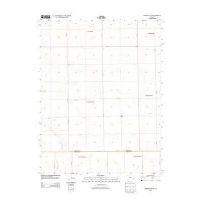
2013 Map of Sheridan Lake SW
USGS Topo · Published 2013About this map
Big Sandy Cr winds through the southwestern corner of this high plains landscape, marking one of the few distinct hydrological features in an area defined by its rigorous grid-system layout. Located at the boundary of Kiowa Co and Prowers Co, the terrain is characterized by the broad, subtle depressions of Coon Valley. The map detail captures the specialized rural infrastructure of the early 21st century, where a dense network of section-line roads like Co Road G and Co Road 59 facilitates movement across the vast agricultural and grazing lands of eastern Colorado. This rectangular survey system remains the dominant influence on the local geography, with Co Highway WW serving as a primary lateral corridor along the county line, connecting the isolated farmsteads and rangelands of this remote prairie region.
Find a feature on this map
26 named features on this map. Tap any name to fly to it.
Don’t see what you’re looking for? This feature index may not catch every label — zoom into the map to look around manually.
Map Details
Editions of this 2013 Sheridan Lake SW Map
This is the sole edition of this map. No revisions or reprints were ever made.
Other maps of this area

1890 · Granada
USGS Topo · 1:125,000

1892 · Lamar
USGS Topo · 1:125,000

1892 · Granada
USGS Topo · 1:125,000

1894 · Granada
USGS Topo · 1:125,000

1954 · Lamar
USGS Topo · 1:250,000

1955 · Granada NW
USGS Topo · 1:24,000

1955 · Granada NE
USGS Topo · 1:24,000

1955 · May Valley
USGS Topo · 1:24,000

1958 · Lamar
USGS Topo · 1:250,000

1968 · Sheridan Lake
USGS Topo · 1:24,000