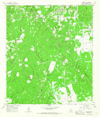
1965 Map of Sheridan
USGS Topo · Published 1967About this map
Sheridan anchors the northern portion of this mid-1960s survey, marking a pocket of settlement near the Colorado Co Lavaca Co border. The landscape is defined by its extensive petrochemical development, characterized by the Sheridan Field and Vienna Gas Field, which are crisscrossed by a network of pipelines and numerous gas wells. Industrial activity is further evidenced by a large Refinery and several gravel pits scattered near the old railroad grade that once served the region's commerce.
Find a feature on this map
27 named features on this map. Tap any name to fly to it.
Don’t see what you’re looking for? This feature index may not catch every label — zoom into the map to look around manually.
Map Details
Editions of this 1965 Sheridan Map
2 editions found
Other maps of this area

1919 · Schulenburg
USGS Topo · 1:62,500

1953 · Seguin
USGS Topo · 1:250,000

1956 · Glidden
USGS Topo · 1:62,500

1958 · Seguin
USGS Topo · 1:250,000

1962 · Sublime
USGS Topo · 1:24,000

1962 · Hallettsville SE
USGS Topo · 1:24,000

1964 · Speaks
USGS Topo · 1:24,000

1965 · Oakland
USGS Topo · 1:24,000

1965 · Sawmill Branch
USGS Topo · 1:24,000

1965 · Rock Island
USGS Topo · 1:24,000