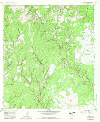
1965 Map of Sheridan
USGS Topo · Published 1983About this map
Sheridan anchors the northern portion of this survey, situated at the edge of an extensive network of waterways and industrial activity in the mid-1960s. The landscape is defined by the extraction economy of Southeast Texas, notably the Vienna Gas Field and the Sheridan Gas Field, which are marked by numerous wells and a prominent Refinery. A local Community Center and the Cheetham Cem offer points of interest for genealogists tracing family roots in this corner of Colorado County near the Lavaca County line.
Find a feature on this map
26 named features on this map. Tap any name to fly to it.
Don’t see what you’re looking for? This feature index may not catch every label — zoom into the map to look around manually.
Map Details
Editions of this 1965 Sheridan Map
2 editions found
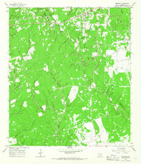
Other maps of this area

1919 · Schulenburg
USGS Topo · 1:62,500

1953 · Seguin
USGS Topo · 1:250,000

1956 · Glidden
USGS Topo · 1:62,500

1958 · Seguin
USGS Topo · 1:250,000

1962 · Sublime
USGS Topo · 1:24,000

1962 · Hallettsville SE
USGS Topo · 1:24,000

1964 · Speaks
USGS Topo · 1:24,000

1965 · Oakland
USGS Topo · 1:24,000

1965 · Sawmill Branch
USGS Topo · 1:24,000

1965 · Rock Island
USGS Topo · 1:24,000