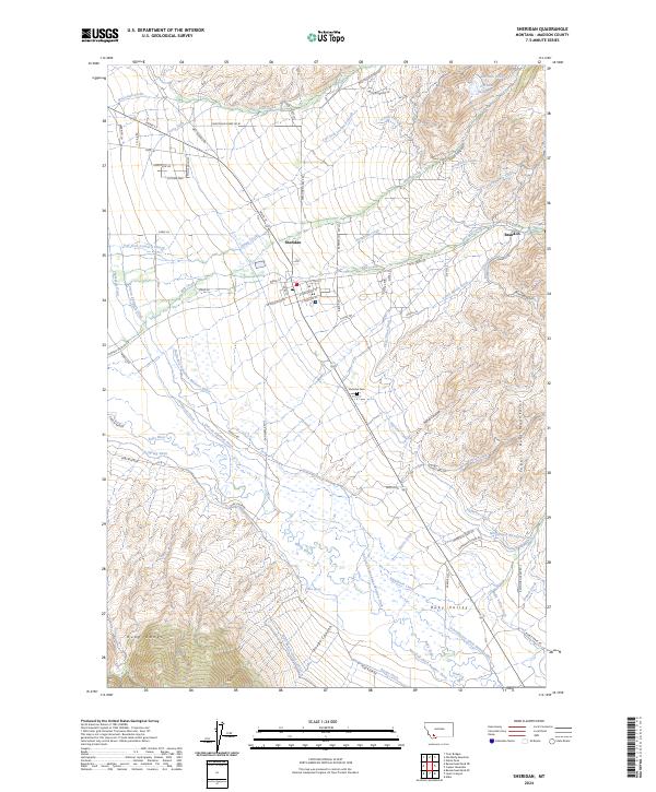
2024 Map of Sheridan
USGS Topo · Published 2024About this map
Sheridan serves as the focal point of this Madison County landscape, situated where the western slopes of the Tobacco Root Mountains meet the expansive Ruby Valley. The map reveals an intricate network of water management essential to this region's ranching and agricultural heritage, including the Vigilante Canal and gravity-fed systems like the Bullerdick Hyndman Moulton Ditch and Schoolhouse Ditch Number One. These diversions from the Ruby River and its tributaries define the land use patterns surrounding the town and the smaller settlement of Brandon.
Find a feature on this map
82 named features on this map. Tap any name to fly to it.
Don’t see what you’re looking for? This feature index may not catch every label — zoom into the map to look around manually.
Map Details
Editions of this 2024 Sheridan Map
This is the sole edition of this map. No revisions or reprints were ever made.
Other maps of this area

1893 · Dillon
USGS Topo · 1:250,000

1955 · Dillon
USGS Topo · 1:250,000

1957 · Dillon
USGS Topo · 1:250,000

1958 · Dillon
USGS Topo · 1:250,000

1960 · Twin Bridges
USGS Topo · 1:62,500

1960 · Waterloo
USGS Topo · 1:62,500

1961 · Beaverhead Rock SE
USGS Topo · 1:24,000

1962 · Dillon
USGS Topo · 1:250,000
1962 · Beaverhead Rock NE
USGS Topo · 1:24,000
1963 · Sheridan
USGS Topo · 1:24,000