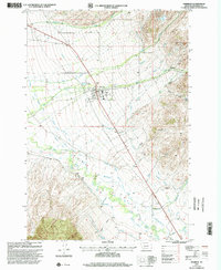
1997 Map of Sheridan
USGS Topo · Published 2002About this map
Sheridan anchors this landscape in the late 1990s, situated at the base of the Ruby Range where the mountain slopes meet the fertile river valley. This geography is defined by a sophisticated water management network, including the Vigilante Canal, West Bench Canal, and the Aqueduct, which divert water from sources like the Ruby River and Wisconsin Creek to support local agriculture. The town itself is shown with its local infrastructure, from the Sheridan Work Center to the Athletic Field and Sheridan Cem.
Find a feature on this map
45 named features on this map. Tap any name to fly to it.
Don’t see what you’re looking for? This feature index may not catch every label — zoom into the map to look around manually.
Map Details
Editions of this 1997 Sheridan Map
This is the sole edition of this map. No revisions or reprints were ever made.
Other maps of this area

1893 · Dillon
USGS Topo · 1:250,000

1955 · Dillon
USGS Topo · 1:250,000

1957 · Dillon
USGS Topo · 1:250,000

1958 · Dillon
USGS Topo · 1:250,000

1960 · Twin Bridges
USGS Topo · 1:62,500

1960 · Waterloo
USGS Topo · 1:62,500

1961 · Beaverhead Rock SE
USGS Topo · 1:24,000

1962 · Dillon
USGS Topo · 1:250,000
1962 · Beaverhead Rock NE
USGS Topo · 1:24,000
1963 · Sheridan
USGS Topo · 1:24,000