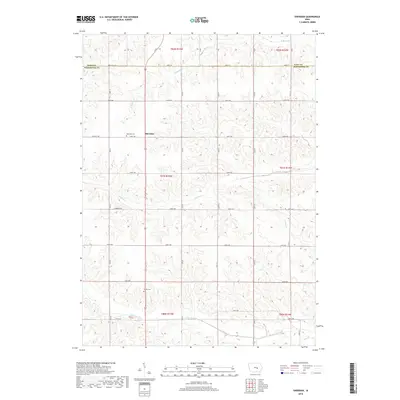
2018 Map of Sheridan
USGS Topo · Published 2018About this map
Sheridan anchors this rural landscape at the intersection of Co Hwy T58 and 320th Ave, serving as the primary settlement hub for the surrounding agricultural townships in northern Poweshiek County. The terrain is defined by an intricate network of waterways, with the north-flowing N Walnut Cr and Walnut Cr carving out the central drainage patterns while Big Bear Cr winds across the southern reaches of the quadrangle.
Find a feature on this map
25 named features on this map. Tap any name to fly to it.
Don’t see what you’re looking for? This feature index may not catch every label — zoom into the map to look around manually.
Map Details
Editions of this 2018 Sheridan Map
This is the sole edition of this map. No revisions or reprints were ever made.
Other maps of this area

1954 · Des Moines
USGS Topo · 1:250,000

1956 · Des Moines
USGS Topo · 1:250,000

1957 · Des Moines
USGS Topo · 1:250,000
1968 · Brooklyn
USGS Topo · 1:24,000
1968 · Belle Plaine SW
USGS Topo · 1:24,000
1968 · Chelsea
USGS Topo · 1:24,000
1969 · Des Moines
USGS Topo · 1:250,000
1979 · Grinnell South
USGS Topo · 1:24,000
1979 · Malcom
USGS Topo · 1:24,000
1980 · Montour
USGS Topo · 1:24,000