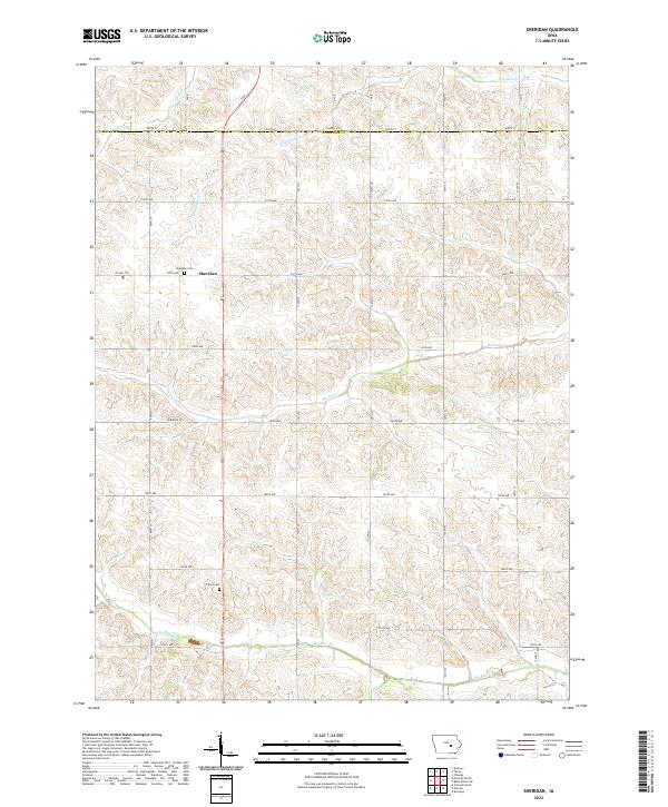
2022 Map of Sheridan
USGS Topo · Published 2022About this map
The settlement of Sheridan anchors the rolling landscape of northern Poweshiek County, where the township grid meets the Tama County line. This region is characterized by its agricultural geometry, defined by a dense network of numbered roads like 90th St and 320th Ave that navigate the headwaters of regional drainages. Local family histories are tied to the grounds at Sheridan Cem and Trinity Cem, which are situated among the gentle divides between Walnut Cr and Big Bear Cr. The terrain is a complex pattern of dendritic stream systems, including Elk Run and Stony Cr, which have dictated the placement of homesteads and farmsteads within the Public Land Survey System squares of Township 81 North. This detailed modern survey from the U.S. Geological Survey illustrates how the rural infrastructure remains fundamentally tied to the original 19th-century land divisions.
Find a feature on this map
38 named features on this map. Tap any name to fly to it.
Don’t see what you’re looking for? This feature index may not catch every label — zoom into the map to look around manually.
Map Details
Editions of this 2022 Sheridan Map
This is the sole edition of this map. No revisions or reprints were ever made.
Other maps of this area

1954 · Des Moines
USGS Topo · 1:250,000

1956 · Des Moines
USGS Topo · 1:250,000

1957 · Des Moines
USGS Topo · 1:250,000

1968 · Brooklyn
USGS Topo · 1:24,000

1968 · Belle Plaine SW
USGS Topo · 1:24,000

1968 · Chelsea
USGS Topo · 1:24,000

1969 · Des Moines
USGS Topo · 1:250,000

1979 · Grinnell South
USGS Topo · 1:24,000
1979 · Malcom
USGS Topo · 1:24,000
1980 · Montour
USGS Topo · 1:24,000