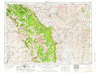
1958 Map of Sheridan
USGS Topo · Published 1958About this map
The Bighorn Mountains dominate the western horizon of this mid-century survey, rising sharply from the plains where the Chicago, Burlington & Quincy RR tracks connect the ranching and mining hubs of north-central Wyoming. In Sheridan, the Fort Mackenzie Veteran Hospital serves as a major landmark, while the Wyoming Soldiers and Sailors Home is situated near Buffalo. The landscape is a study in 1950s resource and land use, showing oil wells and gas fields near Worland and strip mines further east.
Find a feature on this map
135 named features on this map. Tap any name to fly to it.
Don’t see what you’re looking for? This feature index may not catch every label — zoom into the map to look around manually.
Map Details
Editions of this 1958 Sheridan Map
2 editions found

Other maps of this area

1894 · Rosebud
USGS Topo · 1:125,000

1894 · St. Xavier
USGS Topo · 1:125,000

1895 · Dayton
USGS Topo · 1:125,000

1898 · Bald Mountain
USGS Topo · 1:125,000

1899 · Cloud peak
USGS Topo · 1:125,000

1900 · Fort McKinney
USGS Topo · 1:125,000

1901 · Rosebud
USGS Topo · 1:125,000

1901 · Cloud Peak
USGS Topo · 1:125,000

1901 · Dayton
USGS Topo · 1:125,000

1901 · St. Xavier
USGS Topo · 1:125,000