
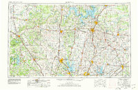
1954 Map of Sherman
USGS Topo · Published 1964About this map
Lake Texoma dominates the northern border of this North Texas and Southern Oklahoma landscape, where the Red River basin transitions from the rolling prairie into the cross-timbers. The mid-century expansion of water management is visible through the Denison Dam, the newly formed Garza-Little Elm Reservoir, and Lavon Reservoir. The map captures a high-density network of railroads including the Missouri-Kansas-Texas RR and St Louis-San Francisco Ry connecting commercial hubs like Sherman and Denison. Notable for genealogists are the rural identifiers such as Courtney P O, Green Valley Sch, and numerous country houses of worship like New Hope Ch and Bethel Ch. Military presence is anchored by Perrin AFB, while conservation efforts are represented by the Hagerman National Wildlife Refuge along the reservoir's southern arms.
Find a feature on this map
197 named features on this map. Tap any name to fly to it.
Don’t see what you’re looking for? This feature index may not catch every label — zoom into the map to look around manually.
Map Details
Editions of this 1954 Sherman Map
2 editions found
Other maps of this area

1891 · Weatherford
USGS Topo · 1:125,000

1891 · Dallas
USGS Topo · 1:125,000

1891 · Palo Pinto
USGS Topo · 1:125,000

1893 · Dallas
USGS Topo · 1:125,000

1893 · Weatherford
USGS Topo · 1:125,000

1894 · Fort Worth
USGS Topo · 1:125,000

1899 · Atoka
USGS Topo · 1:125,000

1900 · Atoka
USGS Topo · 1:125,000

1901 · Addington
USGS Topo · 1:125,000

1901 · Tishomingo
USGS Topo · 1:125,000