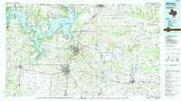
1985 Map of Sherman
USGS Topo · Published 1991About this map
Lake Texoma dominates the northern landscape of this region, where the Red River serves as the winding boundary between Oklahoma and Texas. The map illustrates a mature mid-1980s landscape defined by the expansive waters of the lake, including the Hagerman National Wildlife Refuge and its various arms such as Big Mineral Arm. Industrial and transit corridors are marked by a dense network of major rail lines, including the Missouri-Kansas-Texas RR and St Louis-San Francisco RR, which converge near the regional hubs of Sherman and Denison. Notable river landmarks like Carpenters Bluff and Sowell Bluff punctuate the river's path, while smaller lakeside communities like Sherwood Shores and Cedar Mills highlight the era's recreational and residential development near the water.
Find a feature on this map
130 named features on this map. Tap any name to fly to it.
Don’t see what you’re looking for? This feature index may not catch every label — zoom into the map to look around manually.
Map Details
Editions of this 1985 Sherman Map
This is the sole edition of this map. No revisions or reprints were ever made.
Other maps of this area

1899 · Atoka
USGS Topo · 1:125,000

1900 · Atoka
USGS Topo · 1:125,000

1901 · Tishomingo
USGS Topo · 1:125,000

1901 · Antlers
USGS Topo · 1:125,000

1901 · Ardmore
USGS Topo · 1:125,000

1901 · Denison
USGS Topo · 1:125,000

1902 · Gainesville
USGS Topo · 1:125,000

1903 · Paris
USGS Topo · 1:125,000

1912 · Antlers
USGS Topo · 1:125,000

1918 · Ardmore
USGS Topo · 1:125,000