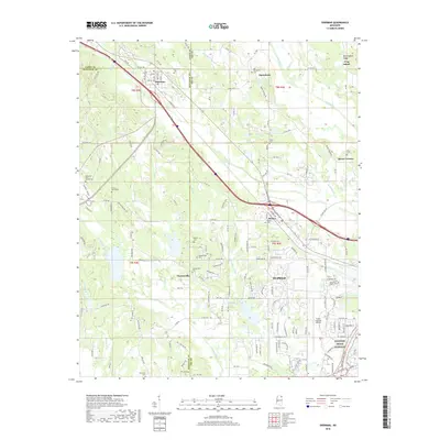
2018 Map of Sherman
USGS Topo · Published 2018About this map
The northwest reaches of Tupelo and the borderlands of Pontotoc, Lee, and Union counties come into sharp focus here. The landscape is defined by the headwaters of numerous waterways, including Town Creek and Coonewah Creek, which carve through the terrain near the small settlements of Sherman and Belden. This modern survey illustrates the suburban expansion of the region, where older rural community centers like Chesterville and Macedonia meet the growing infrastructure of the Tupelo Regional Airport.
Find a feature on this map
167 named features on this map. Tap any name to fly to it.
Don’t see what you’re looking for? This feature index may not catch every label — zoom into the map to look around manually.
Map Details
Editions of this 2018 Sherman Map
This is the sole edition of this map. No revisions or reprints were ever made.
Other maps of this area

1921 · Tupelo
USGS Topo · 1:48,000

1923 · Tupelo
USGS Topo · 1:62,500

1955 · Sherman
USGS Topo · 1:62,500

1956 · Tupelo
USGS Topo · 1:250,000

1958 · Tupelo
USGS Topo · 1:250,000

1966 · Troy NW
USGS Topo · 1:24,000

1966 · Bissell
USGS Topo · 1:24,000

1966 · Verona
USGS Topo · 1:24,000

1973 · Guntown
USGS Topo · 1:24,000
1973 · Tupelo
USGS Topo · 1:24,000