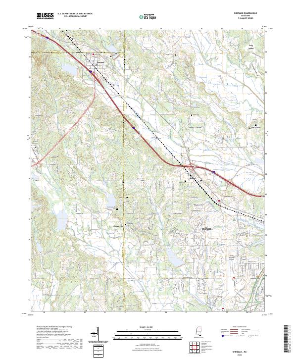
2024 Map of Sherman
USGS Topo · Published 2024About this map
Sherman and Belden anchor the northern reaches of this Mississippi landscape, where the borders of Union, Pontotoc, and Lee counties converge. The terrain is defined by the headwaters of numerous waterways, including Town Creek, Busfaloba Creek, and Little Coonewah Creek, which carve through the elevations of Birmingham Ridge. In the southern portion of the map, the urban expansion of Tupelo is evident near the Tupelo Regional Airport, while the Natchez Trace Parkway cuts across the southeastern corner, following an ancient corridor of travel. Numerous small burial grounds, such as Old Macedonia Cem and Old Chesterville Cem, are scattered throughout the rural sections, offering significant points of interest for genealogists tracing family roots near the settlement of Chesterville.
Find a feature on this map
166 named features on this map. Tap any name to fly to it.
Don’t see what you’re looking for? This feature index may not catch every label — zoom into the map to look around manually.
Map Details
Editions of this 2024 Sherman Map
This is the sole edition of this map. No revisions or reprints were ever made.
Other maps of this area

1921 · Tupelo
USGS Topo · 1:48,000

1923 · Tupelo
USGS Topo · 1:62,500

1955 · Sherman
USGS Topo · 1:62,500

1956 · Tupelo
USGS Topo · 1:250,000

1958 · Tupelo
USGS Topo · 1:250,000

1966 · Troy NW
USGS Topo · 1:24,000

1966 · Bissell
USGS Topo · 1:24,000

1966 · Verona
USGS Topo · 1:24,000

1973 · Guntown
USGS Topo · 1:24,000
1973 · Tupelo
USGS Topo · 1:24,000