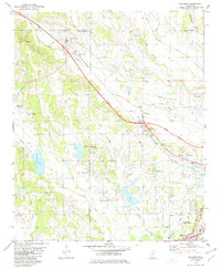
1980 Map of Sherman
USGS Topo · Published 1981About this map
Sherman sits at the intersection of Union, Pontotoc, and Lee Counties, serving as a hub for the surrounding agricultural landscape in the early 1980s. The St Louis-San Francisco railroad cuts a diagonal path through the terrain, paralleled by a proposed location for a new highway corridor that signals the coming expansion toward Tupelo. This era of development is juxtaposed with deeply rooted community landmarks, including the Union Cem, Hickory Grove Cem, and Maxey Cem, which anchor the histories of local families in this corner of Mississippi.
Find a feature on this map
46 named features on this map. Tap any name to fly to it.
Don’t see what you’re looking for? This feature index may not catch every label — zoom into the map to look around manually.
Map Details
Editions of this 1980 Sherman Map
This is the sole edition of this map. No revisions or reprints were ever made.
Other maps of this area

1921 · Tupelo
USGS Topo · 1:48,000

1923 · Tupelo
USGS Topo · 1:62,500

1955 · Sherman
USGS Topo · 1:62,500

1956 · Tupelo
USGS Topo · 1:250,000

1958 · Tupelo
USGS Topo · 1:250,000

1966 · Troy NW
USGS Topo · 1:24,000

1966 · Bissell
USGS Topo · 1:24,000

1966 · Verona
USGS Topo · 1:24,000

1973 · Guntown
USGS Topo · 1:24,000
1973 · Tupelo
USGS Topo · 1:24,000