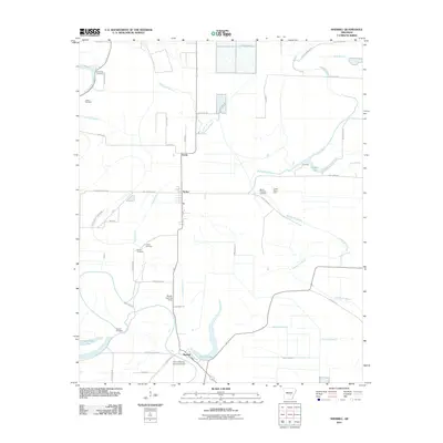
2011 Map of Sherrill
USGS Topo · Published 2011About this map
Wabaseka Bayou and its numerous tributaries, including Indian Bayou and Sleep Bayou, define the drainage patterns of this Jefferson County landscape. The area is characterized by an extensive network of irrigation laterals and drainage ditches, such as Lateral Number 2 and Lateral Number 7, which support the agricultural economy of the Arkansas Delta. The town of Sherrill sits near the southern bend of the bayou, while Tucker and Ferda mark important points to the north.
Find a feature on this map
50 named features on this map. Tap any name to fly to it.
Don’t see what you’re looking for? This feature index may not catch every label — zoom into the map to look around manually.
Map Details
Editions of this 2011 Sherrill Map
This is the sole edition of this map. No revisions or reprints were ever made.
Other maps of this area

1891 · Little Rock
USGS Topo · 1:125,000

1893 · Little Rock
USGS Topo · 1:125,000

1932 · Pastoria
USGS Topo · 1:62,500

1935 · Altheimer
USGS Topo · 1:62,500

1935 · Pastoria
USGS Topo · 1:62,500

1937 · England
USGS Topo · 1:48,000

1939 · Keo
USGS Topo · 1:31,680

1941 · Keo
USGS Topo · 1:31,680

1943 · England
USGS Topo · 1:62,500

1948 · Helena
USGS Topo · 1:250,000