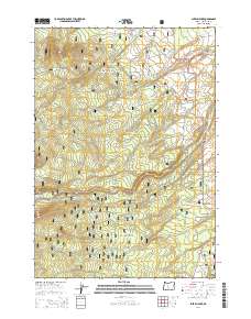
2014 Map of Shevlin Park
USGS Topo · Published 2014About this map
Deschutes National Forest encompasses the majority of this high-elevation landscape west of Bend, where industrial and recreational history converge. The presence of the Columbia Southern Rd and various routes like B-S Logging Rd point to the area's timber heritage, while the protected acreage of Shevlin Park serves as a transition toward more developed lands. Water management is a defining characteristic of the terrain, visible in the path of the Tumalo Feed Canal and the natural drainage of Tumalo Cr. Open clearings such as Fremont Meadow and Pernot Meadow break the forested canopy, offering specific landmarks for those tracing historical land use or regional surveying. This 2014 representation details a network of forest service roads including Skyliners Rd and Big Burn Rd that provide access to the interior of the Cascades foothills.
Find a feature on this map
28 named features on this map. Tap any name to fly to it.
Don’t see what you’re looking for? This feature index may not catch every label — zoom into the map to look around manually.
Map Details
Editions of this 2014 Shevlin Park Map
This is the sole edition of this map. No revisions or reprints were ever made.
Other maps of this area

1926 · Bend
USGS Topo · 1:125,000

1929 · Bend
USGS Topo · 1:125,000

1929 · Three Sisters
USGS Topo · 1:125,000

1930 · Maiden Peak
USGS Topo · 1:125,000

1931 · Newberry Crater
USGS Topo · 1:125,000

1932 · Three Sisters
USGS Topo · 1:125,000

1934 · Maiden Peak
USGS Topo · 1:125,000

1935 · Newberry Crater
USGS Topo · 1:125,000

1955 · Crescent
USGS Topo · 1:250,000

1955 · Bend
USGS Topo · 1:250,000