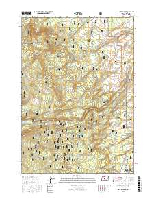
2017 Map of Shevlin Park
USGS Topo · Published 2017About this map
Shevlin Park serves as a gateway between the urban edge of Bend and the sprawling wilderness of the Deschutes National Forest. This landscape illustrates the modern interface of residential growth in communities like Tetherow and Deschutes River Woods with a complex network of recreational and historic corridors. The presence of the Tumalo Feed Canal and the Columbia Southern Rd highlights the region's historical reliance on irrigation and timber transport. High-altitude meadows such as Pernot Meadow and Fremont Meadow break the forested slopes near Seventh Mountain, while drainage systems like Bull Spring Cr and Tumalo Creek provide the essential water resources that defined early settlement patterns in Deschutes County.
Find a feature on this map
50 named features on this map. Tap any name to fly to it.
Don’t see what you’re looking for? This feature index may not catch every label — zoom into the map to look around manually.
Map Details
Editions of this 2017 Shevlin Park Map
This is the sole edition of this map. No revisions or reprints were ever made.
Other maps of this area

1926 · Bend
USGS Topo · 1:125,000

1929 · Bend
USGS Topo · 1:125,000

1929 · Three Sisters
USGS Topo · 1:125,000

1930 · Maiden Peak
USGS Topo · 1:125,000

1931 · Newberry Crater
USGS Topo · 1:125,000

1932 · Three Sisters
USGS Topo · 1:125,000

1934 · Maiden Peak
USGS Topo · 1:125,000

1935 · Newberry Crater
USGS Topo · 1:125,000

1955 · Crescent
USGS Topo · 1:250,000

1955 · Bend
USGS Topo · 1:250,000