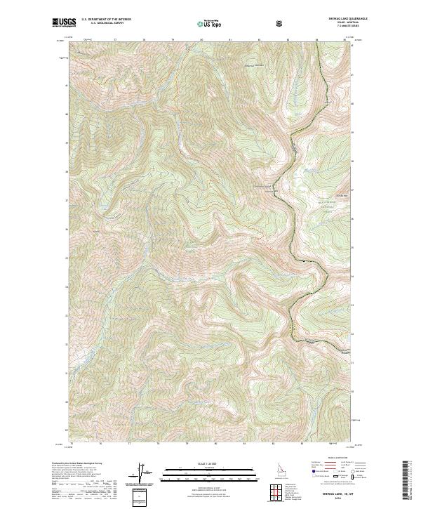
2024 Map of Shewag Lake
USGS Topo · Published 2024About this map
Bitterroot Mountain dominates the high-altitude landscape of this 2024 survey along the Idaho-Montana border. The rugged topography is defined by the sharp transition between the Salmon National Forest and Beaverhead National Forest, following the high ridgelines of the Continental Divide. High-country water features like Shewag Lake and the headwaters of Fourth of July Creek reflect the remote character of this alpine environment. The presence of the Continental Divide National Scenic Trail and the Sheep Creek Trail indicates a landscape primarily utilized for wilderness recreation and conservation. Lower elevations reveal historical access points such as Mine Rd Off Stein Mt Rd, hinting at the region's legacy of resource extraction among the peaks of Pyramid Peak and N Mtn.
Find a feature on this map
47 named features on this map. Tap any name to fly to it.
Don’t see what you’re looking for? This feature index may not catch every label — zoom into the map to look around manually.
Map Details
Editions of this 2024 Shewag Lake Map
This is the sole edition of this map. No revisions or reprints were ever made.
Other maps of this area

1955 · Dillon
USGS Topo · 1:250,000

1957 · Dillon
USGS Topo · 1:250,000

1958 · Dillon
USGS Topo · 1:250,000

1962 · Dillon
USGS Topo · 1:250,000

1965 · Dillon
USGS Topo · 1:250,000

1966 · Badger Spring Gulch
USGS Topo · 1:24,000

1966 · Shewag Lake
USGS Topo · 1:24,000

1966 · Jumbo Mountain
USGS Topo · 1:24,000

1966 · Big Hole Pass
USGS Topo · 1:24,000
1966 · Isaac Meadows
USGS Topo · 1:24,000