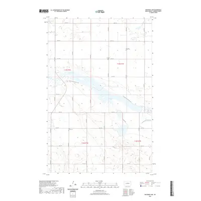
2020 Map of Sheyenne Lake
USGS Topo · Published 2020About this map
Sheyenne Lake and the upper reaches of the Sheyenne River define this rural Sheridan County landscape, where the prairie is organized by a strict section-line road grid. The geography is punctuated by significant water bodies, including Coal Mine Lake and Lone Tree Lake, which break the regularity of the agricultural plots. For genealogists and local historians, several small burial grounds are preserved across these townships, such as Saint Johns Lutheran Cem, Eisenbeisz Cem, and Saint Emanuel Cem. These sites, often adjacent to established section roads like 21st St NE, provide vital markers of the families who settled this region of North Dakota. Modern recreational use is visible through the path of the N Country National Scenic Trail, which skirts the northern shore of the central lakes.
Find a feature on this map
28 named features on this map. Tap any name to fly to it.
Don’t see what you’re looking for? This feature index may not catch every label — zoom into the map to look around manually.
Map Details
Editions of this 2020 Sheyenne Lake Map
This is the sole edition of this map. No revisions or reprints were ever made.
Other maps of this area

1930 · Drake
USGS Topo · 1:62,500

1940 · Aylmer
USGS Topo · 1:62,500

1946 · Sheyenne Lake
USGS Topo · 1:48,000

1947 · Lincoln Valley
USGS Topo · 1:62,500

1947 · Sheyenne Lake
USGS Topo · 1:62,500

1950 · Sheyenne Lake NE
USGS Topo · 1:24,000

1950 · Sheyenne Lake
USGS Topo · 1:24,000

1951 · Martin
USGS Topo · 1:24,000

1951 · Anamoose SW
USGS Topo · 1:24,000

1954 · McClusky
USGS Topo · 1:250,000