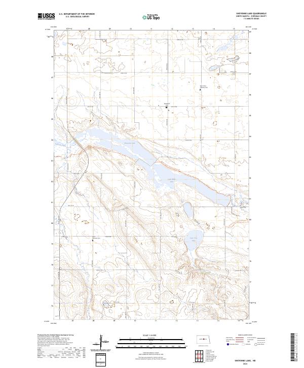
2024 Map of Sheyenne Lake
USGS Topo · Published 2024About this map
Sheyenne Lake National Wildlife Refuge anchors this section of Sheridan County, where the Sheyenne River feeds into a series of prairie potholes and alkaline basins. The landscape is characterized by its hydrologic network, including Coal Mine Lake and Lone Tree Lake, which provide critical habitat in this northern plains environment. Cultural markers are concentrated at rural crossroads, notably at Saint Johns Lutheran Cem and Saint Emanuel Cem, which serve as primary records of the area's early Lutheran settlement. Small family-associated sites like Eisenbeisz Cem further highlight the genealogy of the region. The passage of the North Country National Scenic Trl through the refuge provides a modern recreational corridor through what remains a largely agricultural and conservation-focused landscape.
Find a feature on this map
24 named features on this map. Tap any name to fly to it.
Don’t see what you’re looking for? This feature index may not catch every label — zoom into the map to look around manually.
Map Details
Editions of this 2024 Sheyenne Lake Map
This is the sole edition of this map. No revisions or reprints were ever made.
Other maps of this area

1930 · Drake
USGS Topo · 1:62,500

1940 · Aylmer
USGS Topo · 1:62,500

1946 · Sheyenne Lake
USGS Topo · 1:48,000

1947 · Lincoln Valley
USGS Topo · 1:62,500

1947 · Sheyenne Lake
USGS Topo · 1:62,500

1950 · Sheyenne Lake NE
USGS Topo · 1:24,000

1950 · Sheyenne Lake
USGS Topo · 1:24,000

1951 · Martin
USGS Topo · 1:24,000

1951 · Anamoose SW
USGS Topo · 1:24,000

1954 · McClusky
USGS Topo · 1:250,000