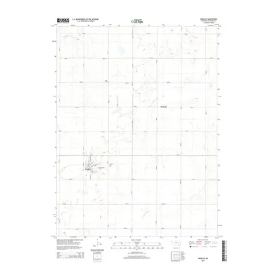
2014 Map of Shickley
USGS Topo · Published 2014About this map
The village of Shickley serves as the primary hub of this agricultural landscape in southern Fillmore County, neatly organized by a precise grid of rural roads. The town's layout is anchored by local thoroughfares such as E S Railroad St and N Market St, reflecting its historical reliance on rail and trade. To the north and east, the small settlement of Martland and various homestead-adjacent roads like Road O and Road 8 define the section-line surveying that characterizes the Great Plains.
Find a feature on this map
29 named features on this map. Tap any name to fly to it.
Don’t see what you’re looking for? This feature index may not catch every label — zoom into the map to look around manually.
Map Details
Editions of this 2014 Shickley Map
This is the sole edition of this map. No revisions or reprints were ever made.
Other maps of this area

1898 · York
USGS Topo · 1:125,000

1898 · Hebron
USGS Topo · 1:125,000

1899 · York
USGS Topo · 1:125,000

1955 · Lincoln
USGS Topo · 1:250,000

1957 · Lincoln
USGS Topo · 1:250,000

1958 · Lincoln
USGS Topo · 1:250,000

1960 · Bruning
USGS Topo · 1:24,000

1960 · Davenport
USGS Topo · 1:24,000

1960 · Carleton
USGS Topo · 1:24,000
1969 · Ong
USGS Topo · 1:24,000