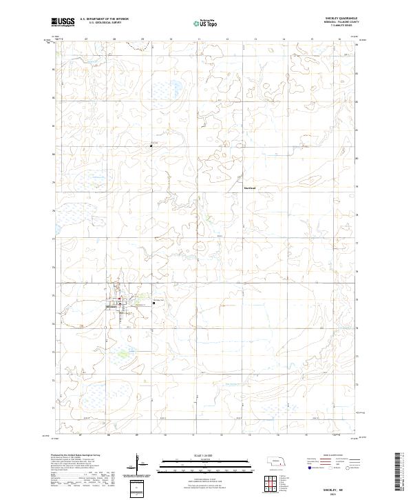
2021 Map of Shickley
USGS Topo · Published 2021About this map
The village of Shickley serves as the central hub for this portion of Fillmore County, showing a tight grid of residential and industrial streets including S Market St and S Railroad St. The surrounding landscape is defined by the agricultural rhythms of south-central Nebraska, where the terrain is marked by seasonal water features like Weis Lagoon and the winding course of Dry Sandy Cr. To the north, the small community of Martland sits within an expanse of section-line roads such as Rd 10 and Rd P. Local heritage is anchored by sites of rest and remembrance, notably Shickley Cem and Zion Cem. The map illustrates a highly organized rural infrastructure, where the township and range boundaries of t6n r4w and t5n r3w dictate a precise geometry of farmsteads and transport routes through the prairie.
Find a feature on this map
28 named features on this map. Tap any name to fly to it.
Don’t see what you’re looking for? This feature index may not catch every label — zoom into the map to look around manually.
Map Details
Editions of this 2021 Shickley Map
This is the sole edition of this map. No revisions or reprints were ever made.
Other maps of this area

1898 · York
USGS Topo · 1:125,000

1898 · Hebron
USGS Topo · 1:125,000

1899 · York
USGS Topo · 1:125,000

1955 · Lincoln
USGS Topo · 1:250,000

1957 · Lincoln
USGS Topo · 1:250,000

1958 · Lincoln
USGS Topo · 1:250,000

1960 · Bruning
USGS Topo · 1:24,000

1960 · Davenport
USGS Topo · 1:24,000

1960 · Carleton
USGS Topo · 1:24,000
1969 · Ong
USGS Topo · 1:24,000