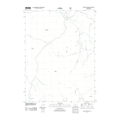
2011 Map of Shield Mountain
USGS Topo · Published 2011About this map
The Little Snake River and its multiple tributaries define the drainage patterns of this high-elevation landscape in the early 21st century. The map centers on the confluence area of the N Frk Little Snake R, Middle Fork Little Snake River, and South Fork Little Snake River, a geography that gives rise to the settlement of Three Forks. The human footprint is concentrated near this waterway junction, including Three Forks Ranch and the Three Forks Cemetery. Beyond the river valley, the terrain is dominated by prominent summits and ridges such as Three Forks Mountain, Piney Mountain, and the massive bulk of Shield Mountain. The distribution of county roads, specifically County RD-129 and Co RD 129, follows the natural contours of the gulches and creeks, including Beeler Gulch and Bedrock Creek, illustrating how the valley floor remains the primary corridor for movement through this mountain environment.
Find a feature on this map
32 named features on this map. Tap any name to fly to it.
Don’t see what you’re looking for? This feature index may not catch every label — zoom into the map to look around manually.
Map Details
Editions of this 2011 Shield Mountain Map
This is the sole edition of this map. No revisions or reprints were ever made.
Other maps of this area

1911 · Hahns Peak
USGS Topo · 1:125,000

1913 · Hahns Peak
USGS Topo · 1:125,000

1932 · Savery
USGS Topo · 1:96,000

1939 · Saratoga
USGS Topo · 1:125,000

1940 · Savery
USGS Topo · 1:125,000

1954 · Rawlins
USGS Topo · 1:250,000

1954 · Craig
USGS Topo · 1:250,000

1957 · Craig
USGS Topo · 1:250,000

1958 · Rawlins
USGS Topo · 1:250,000

1958 · Craig
USGS Topo · 1:250,000