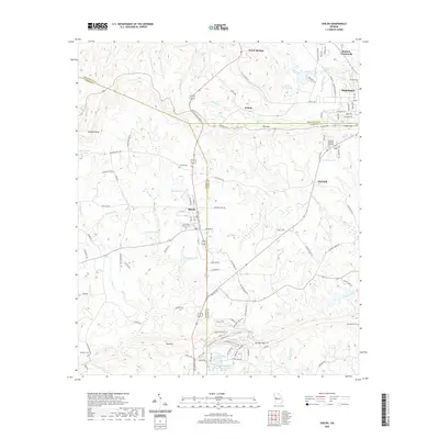
2020 Map of Shiloh
USGS Topo · Published 2020About this map
Pine Mountain and Oak Mountain dominate this corner of West Georgia, where the borders of Meriwether, Harris, and Talbot counties converge. This landscape is defined by its topographic extremes, ranging from the high point at Dowdell Knob to the water-carved descent of Cascade Falls. The small town of Shiloh sits centrally along the main north-south corridor, while the city of Manchester occupies the northeastern edge of the sheet. For those tracing local heritage, the map identifies several rural landmarks including the Old Shiloh Church Cemetery and the remote Macedonia Cemetery. The drainage patterns here are complex, with headwaters like Rush Creek, Pigeon Creek, and Sparks Creek flowing from the ridges toward the surrounding valleys, reflecting a geography that remains largely rural and defined by its natural springs and gaps.
Find a feature on this map
113 named features on this map. Tap any name to fly to it.
Don’t see what you’re looking for? This feature index may not catch every label — zoom into the map to look around manually.
Map Details
Editions of this 2020 Shiloh Map
This is the sole edition of this map. No revisions or reprints were ever made.
Other maps of this area

1907 · Talbotton
USGS Topo · 1:125,000

1934 · Warm Springs
USGS Topo · 1:62,500

1936 · Warm Springs
USGS Topo · 1:62,500

1950 · Talbotton
USGS Topo · 1:24,000

1950 · Waverly Hall
USGS Topo · 1:24,000

1950 · Cataula
USGS Topo · 1:24,000

1950 · Talbotton
USGS Topo · 1:62,500

1950 · Ellerslie
USGS Topo · 1:62,500

1955 · Talbotton
USGS Topo · 1:24,000
1955 · Waverly Hall
USGS Topo · 1:24,000