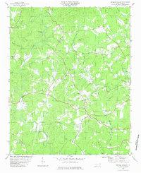
1982 Map of Shingle Hollow
USGS Topo · Published 1983About this map
The Broad River winds through the southern reaches of this terrain, marking the boundary between Rutherford Co and Polk Co. The landscape is defined by the convergence of numerous watercourses including Cove Creek, Piney Creek, and Bills Creek, which flow through a region characterized by prominent elevations like Toma Mountain and Piney Knob. Small rural communities and congregations form the social backbone of the area, centered around Shingle Hollow and Green Hill.
Find a feature on this map
31 named features on this map. Tap any name to fly to it.
Don’t see what you’re looking for? This feature index may not catch every label — zoom into the map to look around manually.
Map Details
Editions of this 1982 Shingle Hollow Map
This is the sole edition of this map. No revisions or reprints were ever made.
Other maps of this area

1900 · Mount Mitchell
USGS Topo · 1:125,000

1902 · Mount Mitchell
USGS Topo · 1:125,000

1905 · Morganton
USGS Topo · 1:125,000

1907 · Saluda
USGS Topo · 1:125,000

1953 · Charlotte
USGS Topo · 1:250,000

1954 · Charlotte
USGS Topo · 1:250,000

1955 · Knoxville
USGS Topo · 1:250,000

1957 · Knoxville
USGS Topo · 1:250,000

1959 · Lake Lure
USGS Topo · 1:62,500

1960 · Knoxville
USGS Topo · 1:250,000