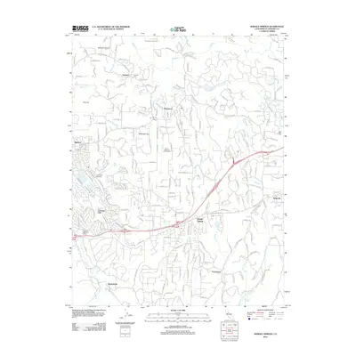
2012 Map of Shingle Springs
USGS Topo · Published 2012About this map
Shingle Springs and the surrounding foothill settlements of El Dorado County are characterized by a complex network of small watercourses and narrow ridges. The landscape is defined by its gold-country heritage, evident in features like the Jayhawk Cem and the Shaw Mine Mill near Slate Cr. Local geography is divided by several prominent drainages, including Weber Cr in the north and Deer Cr to the south.
Find a feature on this map
35 named features on this map. Tap any name to fly to it.
Don’t see what you’re looking for? This feature index may not catch every label — zoom into the map to look around manually.
Map Details
Editions of this 2012 Shingle Springs Map
This is the sole edition of this map. No revisions or reprints were ever made.
Other maps of this area

1891 · Sacramento
USGS Topo · 1:125,000

1891 · Placerville
USGS Topo · 1:125,000

1892 · Sacramento
USGS Topo · 1:125,000

1892 · Placerville
USGS Topo · 1:125,000

1893 · Placerville
USGS Topo · 1:125,000

1893 · Sacramento
USGS Topo · 1:125,000

1941 · Folsom
USGS Topo · 1:62,500
1944 · Auburn
USGS Topo · 1:62,500
1944 · Folsom
USGS Topo · 1:62,500

1947 · Sacramento
USGS Topo · 1:250,000