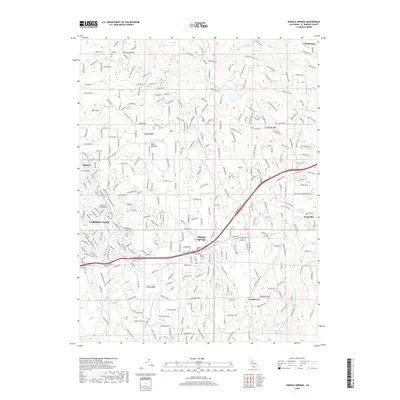
2018 Map of Shingle Springs
USGS Topo · Published 2018About this map
Cameron Park and Shingle Springs serve as the primary hubs in this late-2010s survey of El Dorado County's western foothills. The landscape is characterized by a dense network of suburban residential loops and circles that weave through the natural drainages of Weber Cr, French Cr, and Indian Cr. The Cameron Park Airport is a prominent modern landmark, while the Jayhawk Cem and settlements like Frenchtown and Mormon Ravine offer clear links to the region's earlier heritage. South of the main transit corridor, the terrain remains less developed, surrounding the Big Canyon Reservoir and the high point of Pine Hill. This modern topography illustrates the transition of historic gold-country mining camps into established residential communities, maintaining labels for traditional locales such as Skinners, Kingsville, and Cold Springs alongside contemporary infrastructure.
Find a feature on this map
299 named features on this map. Tap any name to fly to it.
Don’t see what you’re looking for? This feature index may not catch every label — zoom into the map to look around manually.
Map Details
Editions of this 2018 Shingle Springs Map
This is the sole edition of this map. No revisions or reprints were ever made.
Other maps of this area

1891 · Sacramento
USGS Topo · 1:125,000

1891 · Placerville
USGS Topo · 1:125,000

1892 · Sacramento
USGS Topo · 1:125,000

1892 · Placerville
USGS Topo · 1:125,000

1893 · Placerville
USGS Topo · 1:125,000

1893 · Sacramento
USGS Topo · 1:125,000

1941 · Folsom
USGS Topo · 1:62,500
1944 · Auburn
USGS Topo · 1:62,500
1944 · Folsom
USGS Topo · 1:62,500

1947 · Sacramento
USGS Topo · 1:250,000